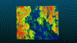
GNSS-Aided Inertial Positioning/Navigation System
Industry leaders in GNSS-aided inertial technology for georeferencing survey data from the air, land and sea.
Performs in the most difficult environments without base stations.
Applanix GNSS-aided Inertial Solutions for Mobile Mapping
Unlock unparalleled precision and reliability in your navigation and positioning tasks with Trimble Applanix's advanced GNSS-Inertial solutions. Trimble's Applanix products integrate Global Navigation Satellite System (GNSS) technology with Inertial Navigation System (INS) to create industry-leading positioning accuracy no matter the sensor or application.
Our products are outfitted with cutting-edge GNSS receivers and Inertial Measurement Units (IMUs), guaranteeing dependable and consistent results characterized by unmatched centimeter-level accuracy. Applanix GNSS-Inertial solutions excel in challenging environments where others struggle, seamlessly navigating through urban canyons, dense foliage, and areas of deliberate signal interference to deliver unparalleled precision.
Why Applanix is the Leader in GNSS-Inertial Solutions Mobile Mapping Solutions?

Superior Reliability
Embedded GNSS receivers with IMUs harness our revolutionary Applanix IN-Fusion+™ technology for high-accuracy in any condition

Versatile Applications
High-accuracy solutions for land surveying, aerial mapping, autonomous vehicle navigation, and marine hydrography

Advanced Georeferencing Software
Achieve maximum productivity and accuracy with the industry's leading Direct Georeferencing post-processing software: Applanix POSPac Mobile Mapping Suite

Flexible Configuration Options
Tailored to accommodate diverse application demands, Applanix GNSS-Inertial solutions are offered both as standalone boxed units for direct implementation and as OEM products for system integrators

Elevated Precision
Integrate with GPS, GLONASS, Galileo, and BeiDou


"We needed to produce very high accuracy data for this project. And that’s why we chose Trimble Applanix. They produce the very best results in the industry."
Gabriel Walton, Technical Director at Ultrabeam
Your Benefits

Greater productivity

Improved process efficiency

Smoother workflow

Rapid return on investment

Increased revenues and profits
Our Core Competencies

Robust position and orientation solutions for sensors and vehicles

Industry-leading GNSS-aided inertial technology

Direct Georeferencing of imaging devices

Sensor fusion and complex systems
Leading the Way with Premier, Cutting-Edge Technology

Trimble Applanix IN-Fusion+
Multi-Sensor Aided Inertial Engine

Unequaled level of accuracy and robustness
Advanced multi-sensor fusion technology

Increased availability
Latest GNSS technologies, SmartCal and RTX (ASIL-B) corrections

Precise Attitude and Heading
1 min cm convergence in fast regions

Advanced motion state measurement
Ability to fuse multiple measurements into a single solution

Trimble CenterPoint® RTX
Positioning Services

Advanced PPP technology

Real-time, centimeter-level positions

Most complete coverage world wide
1 min cm convergence in fast regions

Available for post-processed and real-time use cases

(ASIL-B) ISO 26262 certified and ASPICE compliant
Assured data stream quality and authenticity

Trimble ProPoint® GNSS

5th generation, high precision GNSS positioning technology

Improved performance in challenging environments
Latest GNSS algorithms and seamless RTX integration

Increased availability
Independent tracking loop - functions without multiple frequencies for each satellite

Better protection against jamming, spoofing and multipath
Advanced signal filtering and error modeling

Enhanced Constellation Support
Triple frequency, GPS, GLONASS, BeiDou, QZSS, Galileo

Maxwell Technology
Trimble proprietary survey grade GNSS ASIC

Multi-constellation, multi-frequency tracking using Adaptive Frequency Locked Loop technique
Precision in Every Environment: Discover Why Our Partners Trust Us to Meet Their Complex Needs

LAND MOBILE MAPPING
Fraunhofer IPM Advances Urban Mapping with Trimble's Applanix Technology for Deutsche Telekom's Fiber-Optic Planning

HYDROGRAPHIC SURVEY
SEP Hydrographic Enhances Asset Inspection Capabilities with Trimble Applanix's Advanced Marine Technology

AERIAL MAPPING
Precision Mapping Redefined: SmartDrone Empowered by Trimble's Applanix Direct Georeferencing Technology
Why Trimble Applanix?
Whether it drives, flies or floats, you can trust your position with Trimble Applanix

Custom Solutions
More sensors, more data, more complexity. As engineers who continue to champion the latest and most accurate sensor technologies, we listen and work with you to customise a sensible solution that fits your objectives and your budget.

Deep Industry Knowledge
With 30+ years of expertise, our engineers are recognised as industry-leading experts who understand every component of the systems required to provide the most accurate positioning in any condition. They're here to guide you and your business to achieve the most reliable results.

Leading Worldwide Support
Our team isn't your typical call center. Each member is a skilled engineer ready to provide valuable solutions, preventing costly downtime. We'll even dispatch replacements or meet you in the field to ensure your success.

Get in Touch
With unparalleled accuracy and a drive to help you succeed, our team of experts can support your most challenging applications.
Terms of Use Privacy Statement Trademark Information Do Not Sell My Personal Information ©2024, Trimble Applanix